
DJI Matrice 4E Combo
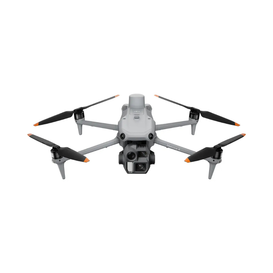
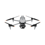
The DJI Matrice 4E Combo is a professional enterprise drone designed for surveying, mapping, construction, inspection, infrastructure monitoring and geospatial applications. It combines a 4/3-inch 20MP wide-angle camera, 48MP medium-tele and 48MP tele cameras, a laser rangefinder, RTK positioning, AI-powered intelligent operations and high-efficiency mapping capabilities.
The Matrice 4E can capture images at intervals as short as 0.5 seconds and supports 5-directional oblique capture, 3-directional ortho capture and Smart 3D Capture, making it particularly suited to professional aerial surveying and mapping workflows.
DJI Matrice 4E Combo – Professional Surveying & Mapping Drone
The DJI Matrice 4E Combo is a compact yet powerful enterprise drone engineered for professionals who need accurate aerial data, detailed imaging and efficient mapping workflows. With a multi-camera payload, RTK positioning, laser rangefinding and intelligent flight capabilities, DJI Matrice 4E is built to support demanding surveying, mapping, construction and inspection operations.
From land surveying and topographic mapping to construction progress monitoring and infrastructure inspections, Matrice 4E provides the imaging and flight intelligence required for professional aerial data collection.
4/3-Inch 20MP Wide-Angle Camera
The main camera features a 4/3-inch CMOS sensor with 20MP effective pixels, offering detailed aerial imagery for surveying and mapping applications. Its 24mm-equivalent lens provides a wide field of view, while the adjustable f/2.8–f/11 aperture provides greater exposure control.
The camera also features a mechanical shutter, helping minimize rolling-shutter distortion during aerial mapping and rapid image capture.
48MP Medium Telephoto Camera
The 48MP medium telephoto camera uses a 1/1.3-inch CMOS sensor and a 70mm-equivalent focal length. It is designed to capture detailed views of objects and infrastructure from a distance, making it useful for inspections and asset monitoring.
48MP Telephoto Camera
The 48MP telephoto camera features a 1/1.5-inch CMOS sensor and a 168mm-equivalent focal length. This extended reach allows professionals to inspect distant structures and capture details without flying unnecessarily close to the subject.
Laser Rangefinder
DJI Matrice 4E integrates a laser rangefinder to enable real-time distance and measurement capabilities. This can help operators obtain more actionable spatial information during inspection and surveying workflows.
High-Efficiency Aerial Mapping
Matrice 4E is purpose-built for efficient aerial surveying. It supports 5-directional oblique capture, 3-directional ortho capture and Smart 3D Capture. The drone can also shoot at intervals as short as 0.5 seconds, helping reduce the time required for large-area data collection.
RTK Positioning for Precision
With RTK support, DJI Matrice 4E can achieve centimeter-level positioning accuracy when an RTK Fix is available. DJI specifies RTK accuracy of 1 cm + 1 ppm horizontally and 1.5 cm + 1 ppm vertically under the stated conditions.
This makes Matrice 4E particularly suitable for professional surveying, mapping and geospatial applications where positioning accuracy is important.
AI-Powered Intelligent Operations
Matrice 4E incorporates AI-powered capabilities designed to improve operational efficiency. The system can intelligently identify subjects such as vehicles and vessels and supports functions including Cruise, FlyTo, Smart Track and POI.
Omnidirectional Obstacle Sensing
The Matrice 4 Series incorporates omnidirectional sensing and an integrated GNSS and vision positioning system to improve flight awareness and navigation. Its low-light sensing capabilities also help support operations in challenging lighting conditions.
Up to 49 Minutes Flight Time
DJI Matrice 4E offers up to 49 minutes of maximum flight time with standard propellers in DJI's specified windless test conditions. With low-noise propellers, the maximum rated flight time is 46 minutes. Actual flight time varies according to operating conditions, flight mode and accessories.
DJI O4 Enterprise Transmission
The Matrice 4 Series uses DJI O4 Enterprise video transmission, designed to provide reliable long-range connectivity for enterprise operations. DJI states a transmission range of over 20 km in specified conditions and regions.
DJI RC Plus 2 Enterprise
The system works with the DJI RC Plus 2 Enterprise, a dedicated enterprise remote controller featuring a 7.02-inch 1400-nit display, built-in 6500mAh battery and support for microSD expansion. It is designed for professional field operations and DJI Pilot 2 workflows.
| Specification | DJI Matrice 4E |
|---|---|
| Product Type | Enterprise Surveying & Mapping Drone |
| Takeoff Weight | Approx. 1,219 g |
| Maximum Takeoff Weight | 1,420 g with standard propellers |
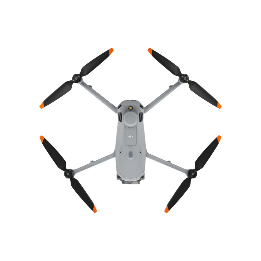
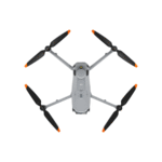
| Folded Dimensions | 260.6 × 113.7 × 138.4 mm |
| Unfolded Dimensions | 307 × 387.5 × 149.5 mm |
| Maximum Payload | 200 g |
| Maximum Flight Time | Up to 49 minutes |
| Maximum Hover Time | Up to 42 minutes |
| Maximum Flight Distance | Up to 35 km in specified conditions |
| Maximum Horizontal Speed | 21 m/s |
| Maximum Ascent Speed | 10 m/s |
| Maximum Descent Speed | 8 m/s |
| Wind Resistance | Up to 12 m/s |
| Operating Temperature | -10°C to 40°C |
| Positioning | GNSS + Vision + RTK |
| RTK Accuracy | 1 cm + 1 ppm horizontal; 1.5 cm + 1 ppm vertical |
| Main Camera | 4/3-inch CMOS, 20MP |
| Main Camera Focal Length | 24mm equivalent |
| Main Camera Aperture | f/2.8–f/11 |
| Medium Tele Camera | 1/1.3-inch CMOS, 48MP |
| Medium Tele Focal Length | 70mm equivalent |
| Tele Camera | 1/1.5-inch CMOS, 48MP |
| Tele Focal Length | 168mm equivalent |
| Laser Rangefinder | Yes |
| Maximum Photo Resolution | Up to 8192 × 6144 |
| Minimum Photo Interval | 0.5 seconds |
| Video Resolution | 4K/30fps |
| Video Codec | H.264 / H.265 |
| Maximum Video Bitrate | H.264: 60 Mbps; H.265: 40 Mbps |
| Transmission System | DJI O4 Enterprise |
| Transmission Range | Over 20 km under specified conditions |
| Obstacle Sensing | Omnidirectional |
| Mapping Features | 5-directional oblique, 3-directional ortho, Smart 3D Capture |
| Remote Controller | DJI RC Plus 2 Enterprise |
| Storage | microSD supported |
| Supported microSD | U3/Class 10/V30 or above |
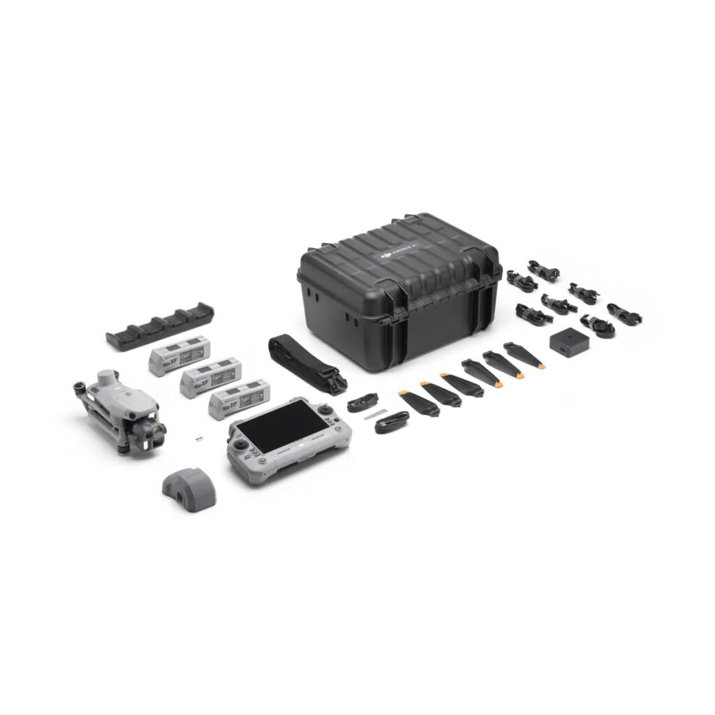
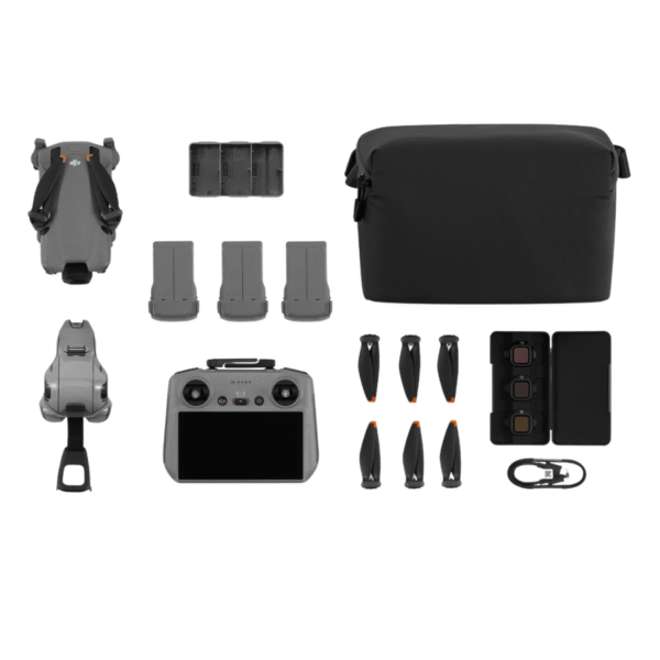
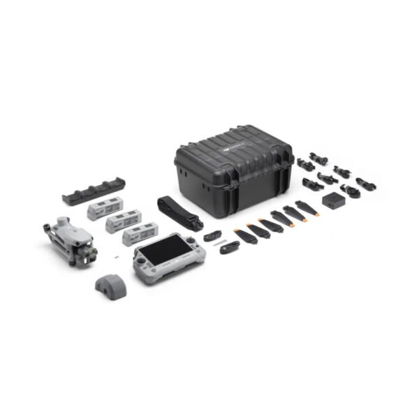
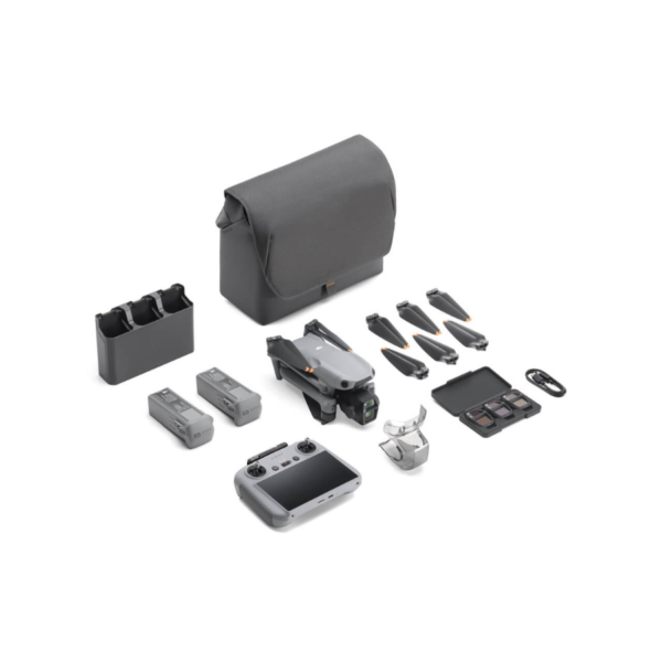
What's Included – DJI Matrice 4E Combo
| Item | Quantity |
|---|---|
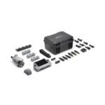
| DJI Matrice 4E Aircraft | 1 |
| DJI Matrice 4 Series Battery | 1 |
| DJI RC Plus 2 Enterprise | 1 |
| DJI 100W USB-C Power Adapter | 1 |
| DJI Matrice 4 Series Charging Hub | 1 |
| microSD Card | 1 |
| DJI Matrice 4E Gimbal Protector | 1 |
| DJI Cellular Dongle 2 Pry Bar | 1 |
| DJI Matrice 4 Series Propellers | 3 sets |
| 100W Power Adapter AC Cable | 1 |
| USB-C to USB-C Data Cable | 2 |
| DJI Matrice 4 Series Storage Case | 1 |
| Storage Case Shoulder Strap | 1 |
Best Applications
The DJI Matrice 4E is particularly suitable for:
- Land surveying
- Aerial mapping
- Photogrammetry
- Topographic surveys
- Construction site monitoring
- Infrastructure inspection
- Road and bridge inspection
- Mining and quarry surveys
- Powerline and utility inspection
- Urban planning
- 3D modeling
- Real estate and large-site documentation
- GIS and geospatial data collection
DJI specifically positions the Matrice 4E for surveying, mapping, construction and inspections.
FAQs – DJI Matrice 4E Combo
1. What is the DJI Matrice 4E Combo?
The DJI Matrice 4E Combo is a professional enterprise drone designed primarily for surveying, mapping, construction, inspection and geospatial applications.
2. What camera does DJI Matrice 4E have?
DJI Matrice 4E has a 20MP 4/3-inch CMOS wide-angle camera, a 48MP 1/1.3-inch medium telephoto camera and a 48MP 1/1.5-inch telephoto camera.
3. Does DJI Matrice 4E have RTK?
Yes. DJI Matrice 4E supports RTK positioning and can achieve centimeter-level positioning accuracy when operating with an RTK Fix.
4. What is the flight time of DJI Matrice 4E?
DJI Matrice 4E has a maximum rated flight time of 49 minutes with standard propellers under DJI's specified test conditions.
5. Does DJI Matrice 4E have a laser rangefinder?
Yes. The Matrice 4E includes a laser rangefinder designed for distance measurement and professional aerial operations.
6. Is DJI Matrice 4E suitable for surveying?
Yes. It is specifically designed for surveying, mapping and professional aerial data collection, with features such as RTK, mechanical shutter, rapid image capture and dedicated mapping modes.
7. Can DJI Matrice 4E be used for mapping?
Yes. It supports 5-directional oblique capture, 3-directional ortho capture and Smart 3D Capture, making it suitable for professional mapping workflows.
8. What is the minimum photo interval on Matrice 4E?
The Matrice 4E supports a minimum photo interval of 0.5 seconds, which is useful for high-efficiency aerial mapping.
9. Does DJI Matrice 4E have obstacle avoidance?
Yes. It uses omnidirectional obstacle sensing and a GNSS/vision integrated positioning and navigation system.
10. What remote controller comes with DJI Matrice 4E?
The standard enterprise controller is the DJI RC Plus 2 Enterprise.
11. What is the transmission range of DJI Matrice 4E?
DJI O4 Enterprise provides a 20 km+ maximum transmission range under specified conditions and regions. Actual performance depends on interference, environment and local regulations.
12. Is DJI Matrice 4E waterproof?
No. DJI states that the Matrice 4 Series is not waterproof. It should not be exposed to rain or water during operation.
13. What is the difference between DJI Matrice 4E and Matrice 4T?
The Matrice 4E is optimized for surveying, mapping and inspection with its 4/3-inch 20MP main camera and dual tele cameras. The Matrice 4T adds thermal imaging, NIR illumination and a different wide-camera configuration, making it more focused on thermal inspection, public safety and search-and-rescue applications.
14. Is DJI Matrice 4E suitable for construction?
Yes. Its high-resolution imaging, RTK positioning, mapping features and intelligent flight functions make it suitable for construction surveying, site documentation, progress monitoring and inspection workflows.
15. Who should buy DJI Matrice 4E Combo?
DJI Matrice 4E is best suited for surveyors, civil engineers, construction companies, GIS professionals, mapping teams, infrastructure inspectors, mining professionals and other enterprise users requiring accurate aerial data.
16. Can DJI Matrice 4E be used with DJI Terra?
Yes. DJI's Matrice 4E ecosystem is designed for professional mapping workflows and integration with DJI Terra for processing and surveying applications.
17. Does DJI Matrice 4E support night operations?
The Matrice 4 Series has enhanced low-light omnidirectional sensing and Night Scene capabilities, supporting improved flight awareness in low-light environments.
18. What makes DJI Matrice 4E different from consumer DJI drones?
Unlike consumer-focused DJI drones, Matrice 4E is purpose-built for enterprise surveying, mapping and inspection. It offers RTK, a mechanical shutter, multi-camera imaging, laser rangefinding and dedicated professional mapping workflows.






Reviews
There are no reviews yet.